Salkantay is a 20,574-foot mountain, the highest of the Cordillera Vilcabamba, part of the Peruvian Andes, to the West of Machu Picchu. You can hike below its snow-capped peak (that has never been summited successfully!) along an icy river and up to 15,300 feet of elevation, rather than slogging the trekker-choked Inca trail. The company we chose, Salkantay Trekking, was run by a really friendly ex-guide, who even came to our hostel the night before to make sure that Eric was up for the task. At 6:00 the next morning we were picked up along with the rest of the group to begin our journey: five days and four nights, culminating at Machu Picchu.
Our group was an interesting mix of eager, young travelers, seasoned Kilimanjaro vets, global-warming deniers (and birthers!), and a pair of self-proclaimed “proper hippies” from England. Our guide, Wilfredo, aka Chilly Willy, had done the trek hundreds of times and was incredibly knowledgeable when it came to the region’s history and environment. Our guide team consisted of a Cook, Cristobal, and his assistant, Anis who almost never spoke, four horses/mules to carry all of our clothes, gear, tents, cooking supplies and food for the whole trip (including a propane tank!), and their handler, Jesus.
Day 1: Cusco – Soray Pampa
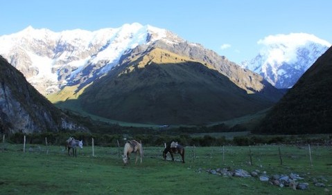
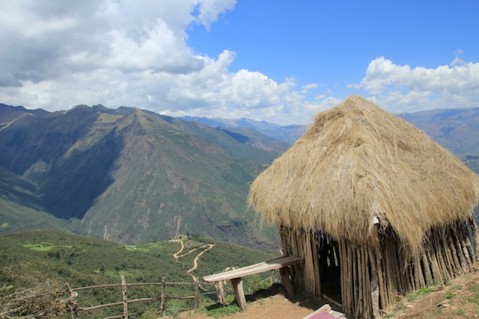
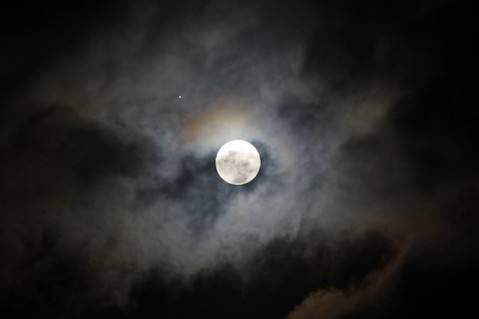
After a short drive and a little trailside introduction from Willy, we started to hike. This is the day we learned about “Peruvian Flat,” which is, basically, constantly hiking up and then down, over and over. We stopped for lunch in a little hut on the side of a hill (our guide team beat us by long enough to start serving pretty much as soon as we sat down), and we realized we would be eating very well. We hiked for about six hours total and finished the day in a field at the foot of Salkantay. It was freezing cold, so we bundled up and went into the dining room tent for “happy hour,” a snack of popcorn, crackers, and tea that preceded dinner each day. Some of us (ahem, Laura) were in pretty bad shape due to the altitude, or maybe dehydration, or maybe exhaustion, and went straight to bed. The group enjoyed snow-cap views, a nearly full moon and the sounds of a river rushing nearby.
Day 2: Soray Pampa – Chaullay via Salkantay Pass
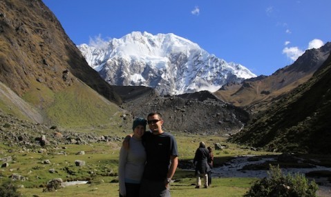
Though we had been warned in our orientation that this would be a long day of hiking, no one in the group was totally prepared for just how hard it turned out to be. We hiked almost 12 hours from a glacially cold campsite, to the highest point on the whole trek, and then down to a cloud forrest-like tropical clime (heat, mosquitoes and all). The mid-point of the day was the Salkantay Pass, glute-busting switchbacks leading all the way up to approximately 15,300 feet. Here, our guide told us the snowy peaks were much less snowy these days due to global warming, and we learned that some of our compatriots thought that was poppycock. Eric wanted to pick a fight but everyone else in the group was too tired to have his back. We moved on down hill for the rest of the day, much to the dismay of our knees, ankles, and backs. In addition to being taken aback by the challenges of day two, we were also stunned over and over by the views. Neither of us had ever seen shining snowcaps quite so impressive, and the scenery kept us plugging along. The group all celebrated our achievement at dinner that night, and collapsed into our tents which were somewhat awkwardly pitched in a family’s backyard. Some of us made use of the cold showers provided outside. Most of us tried to avoid the toilets.
Day 3: Chaullay – Santa Teresa and Thermal Baths
A not-too-tough day followed our killer second day. We hiked five or six hours (mostly downhill again) through beautiful woods along, and sometimes across, a rushing river. The sun wasn’t too hot, but the climate and altitude were a stark contrast to where we began the day before. We stopped for lunch at Playa (a town, not a playa) and then got a ride to Santa Teresa where we helped set up camp, said some awkward hellos to other groups camping at the same place and were driven to a nearby thermal bath to soothe our aching muscles. Camping night three was also a juxtaposition to the first night on the trail. We were set up in a courtyard between a couple buildings: a convenience store, hotel-like rooms for the guides, and concrete-walled kitchens and dining areas. Multiple groups were jammed in together and the site provided a fire pit and loud music (and strobe lights!) for the nighttime entertainment. It was the exact opposite of what we could have hoped for, though our chef continued to shine, and the moon was brilliant that night.
Day 4: Santa Teresa – Aguas Calientes
After our last night camping we had another non-hiking activity: zip-lining! Allegedly the longest and highest zip line in all of South America, it zig-zags six times between two different mountains and over a river. Laura went with the GoPro strapped to her helmet, naturally. (LauraCam video coming soon!) It was equal parts awesome and terrifying, and a lot of people (Eric included) rode upside down for one of the runs. After getting our adrenaline rush, we ate our last Cristobal-cooked meal and prepared to take our last “family photo” before the cooks bid us farewell. It was then that we realized our little camera didn’t make it to lunch with us. We never found it, so unfortunately we lost a lot of our photos from Lima, some in Cusco, and most of the preceding days of the trek. Slightly bummed, we chocked it up to a sacrifice to the Inca ancestors and were on our way to Aguas Calientes. This part of our hike was actually along the original Inca Trail, which is now covered in train tracks. Laura couldn’t stop thinking about the movie Stand By Me. Eric tried to flatten coins on the tracks when the train went by to no avail. Since this part of the trek was “actual flat” it passed mostly without incident and we ended up in the quaint hilly town that’s the entrance point to Machu Picchu. A celebratory dinner (and Pisco Sour!) plus beds and warm showers awaited, as we spent our last night in a hotel.
Day 5: Aguas Calientes – Machu Picchu
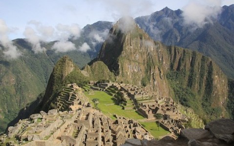
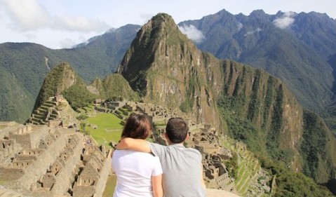
For our final ascent to Machu Picchu, we had the option to wake up at 4:00 am and hike over 1,000 stairs straight up from town, or wake up closer to five and catch a bus straight to the entrance. We had planned all along to hike the last bit, but our bodies thought differently when the time came. Eric’s knees had never quite bounced back after that brutal day 2 (we’re hoping its nothing serious), and Laura was, well, not really prepared for five days of hiking to begin with. There is, of course, a luxury hotel right at the entrance of the park, and a cafeteria selling sodas, hot dogs and the like, but once inside the gates, that all disappears and you’re surrounded by an absolute marvel of gravity defying architecture and stunning mountains at every side. The “urban planning” seems to make more sense than most modern cities. It really is incredible.
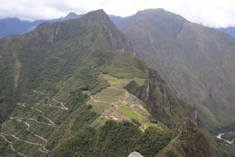
The pointy mountain just behind Machu Picchu that you see in most postcard shots is called Huayna Picchu; another many-stairs hike and this one we decided not to skip. After a very thorough guided tour by Willy, we took off straight uphill for the amazing views that would be the payoff for the whole trip. Standing at 1,180 feet above Machu Picchu, you can really appreciate the scope of the city where, according to legend, one thousand people once lived. It felt great to get up there and culminate such an incredible adventure. Sadly it took us quite a while to hobble down the steep path, given one of Eric’s knees was barely bending at that point.
An evening train and long van ride took us back to Cusco where we were welcomed by our friends at Mama Simona once again, and have enjoyed resting up for a few days. Tonight we head by bus to Copacabana, Bolivia, on the shores of Lake Titicaca. We’re proud of what we accomplished here, and excited to see what’s next.
Here’s where we were:
(Machu Picchu, Peru)

Pingback: Copacabana & Island of the Sun(burn). | We're Outta Town
Pingback: Patagonia! Torres del Paine. | We're Outta Town